Institute of Automation · Faculty of Electrical Engineering and Computer Science
Signal where others see only noise.
The Laboratory for Signal Processing and Remote Control is one of the three laboratories of the Institute of Automation at the Faculty of Electrical Engineering and Computer Science, University of Maribor. We research radar signal processing and systems analysis in sensing, measurement and control engineering, machine vision, remote sensing and remote control — we develop methods for analysing radar, satellite and image data, from detecting unmanned aerial vehicles to monitoring soil moisture from space.
Research areas
From the raw signal to a useful decision.
Radar signal processing
Analysis of ground-penetrating radar and SAR data for detecting subsurface structures and estimating soil properties.
Visual inspection of industrial products
Camera systems for automatic quality control – from finding porosity in aluminium castings to recognising lettering and measuring its position.
Remote sensing
Processing of satellite images for monitoring soil moisture and other environmental parameters.
Remote control
Design and control of autonomous and robotic systems, from two-wheeled robots to ducted-fan drives.
01 / From our work
Projects and theses
Detection of unmanned aerial vehicles

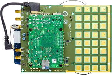
A camera and an FMCW radar at 10 GHz detect drones together. The camera recognises them with the YOLOv8 algorithm on an NVIDIA Jetson platform, while the radar measures range and velocity – together they are more reliable in different weather conditions.
Searching for buried explosives from the air
A miniature ground-penetrating radar on an unmanned aerial vehicle. SAR and microwave tomography reveal the shape and size of a buried object, and machine learning classifies it.
Methods for detecting buried objects
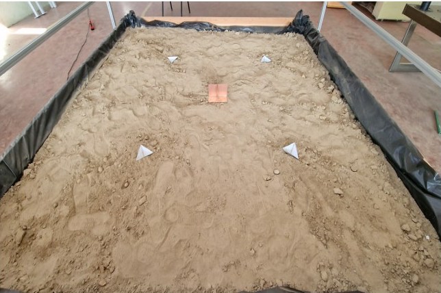
We compared three GPR acquisition modes – downward-looking, side-looking and circular SAR. Back-projection focusing turns the hyperbolas in the radargram into point images of buried objects.
Estimating water pipeline leakage from SAR images
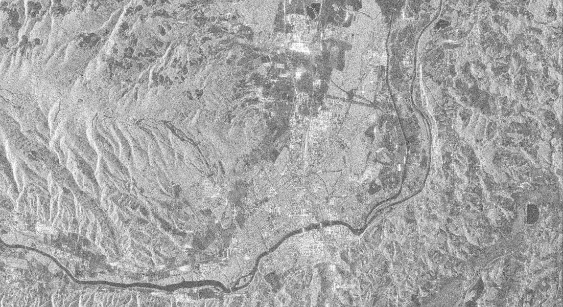
Using polarimetric SAR images from the ALOS-2 satellite (L-band), we look for places where water leaks from buried water pipes. An attention neural network and Kolmogorov–Arnold networks produce a leakage probability map for the whole network – as a pre-selection for targeted searches in the field.
Camera inspection of aluminium castings
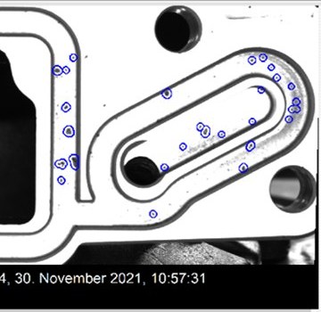
For a manufacturer of aluminium automotive components we built two machine vision systems that inspect turbocharger housing castings. The program finds pores and other defects at the inspected locations and rejects non-compliant parts from the assembly line.
Camera inspection of Bosch lettering
A camera device captures the lettering on a housing; our program recognises the individual letters and measures the X and Y position of the lettering in millimetres – checking whether the lettering is correct and in the right place.
Removing speckle noise from SAR images
SAR radar images are covered by grainy speckle noise that makes them hard to interpret. Deep neural networks remove it while preserving edges and details – a basis for more accurate image analysis.
Agile two-wheeled robot
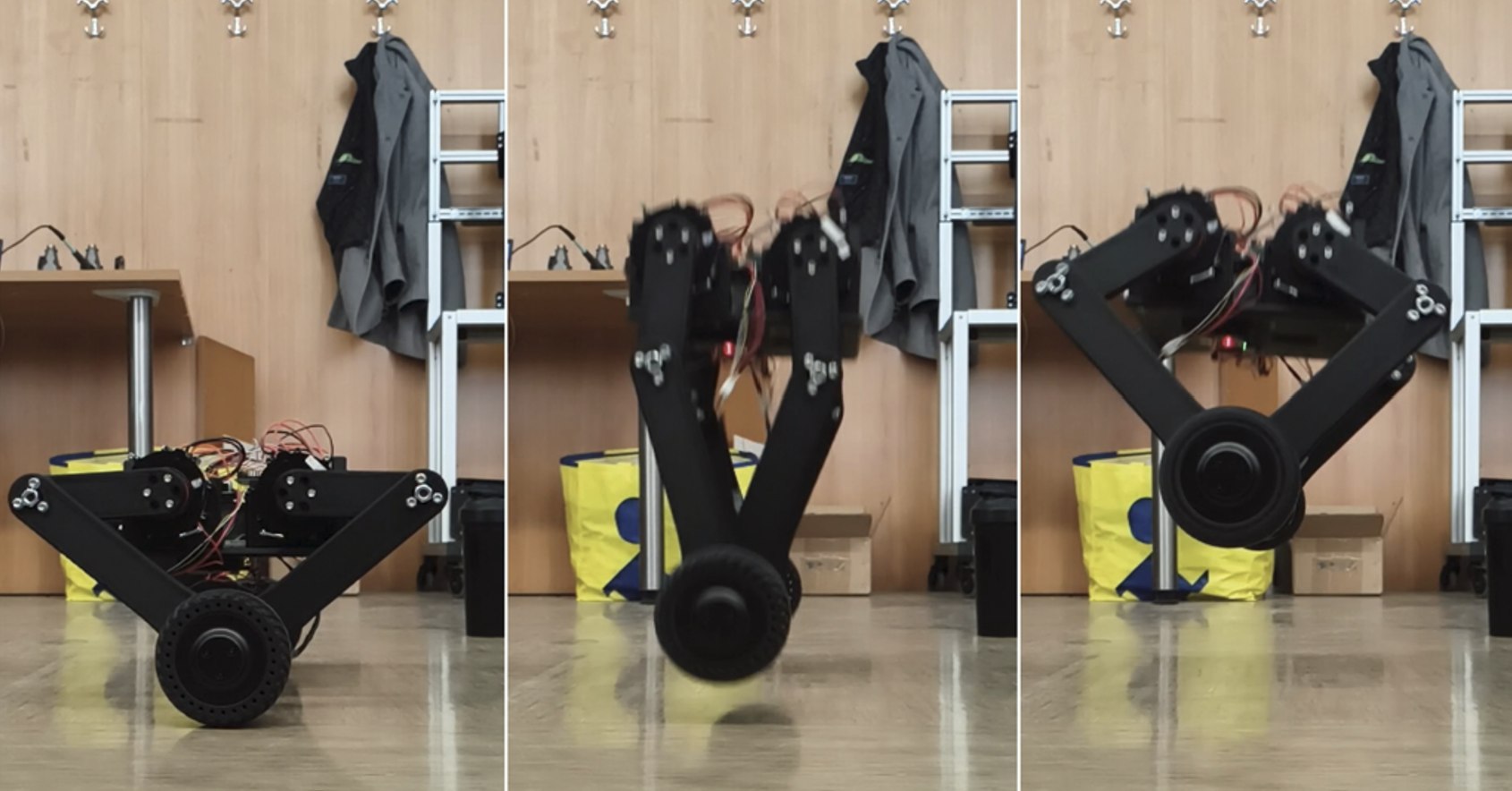
The robot balances itself, drives over uneven terrain and overcomes obstacles. An LQI controller on an STM32 microcontroller keeps it balanced, and a movable upper body allows fast manoeuvres.
A rocket that lands by itself
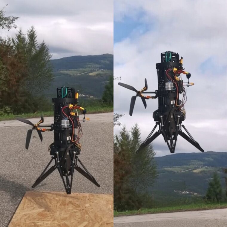
A prototype with an electric ducted fan (EDF) and thrust vectoring hovers automatically and lands in a controlled way. Stability is ensured by a cascade of controllers.
OFDM radar on the USRP platform
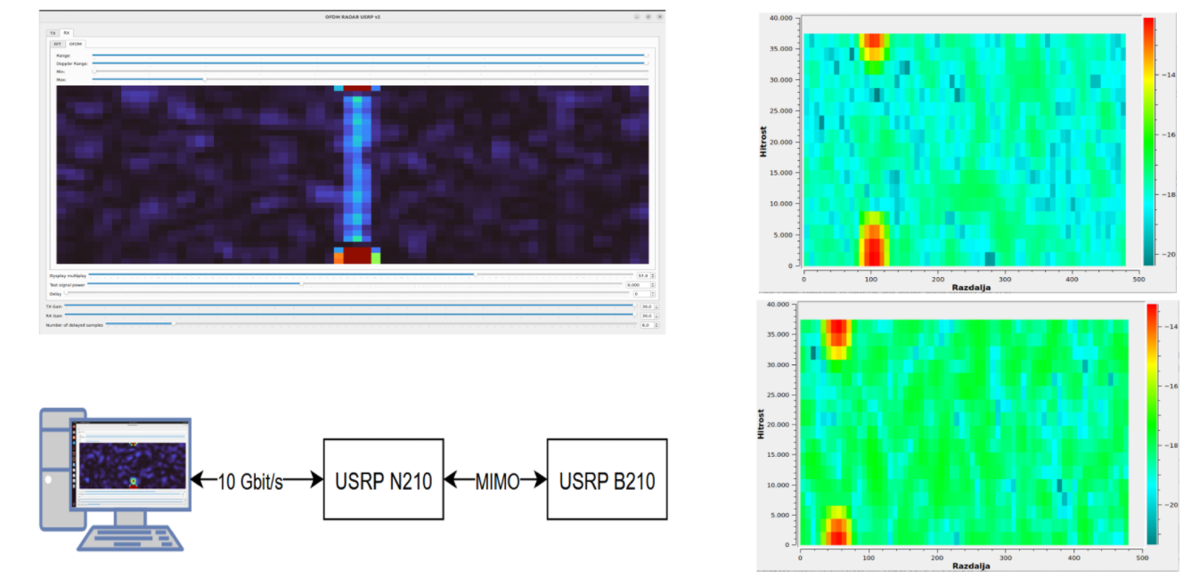
A radar using OFDM modulation – the same as Wi-Fi and 5G. It is implemented on a USRP software-defined radio, so it can be changed in software.
Localisation with ultra-wideband radio
The position of a node is determined from the time of flight of ultra-wideband (UWB) radio signals to fixed anchor points – even indoors, where GPS does not work.
Contact